« May 2022 | Main | July 2022 »
June 29, 2022
Vail Pass, Shrine Pass, Freemont Pass, Trout Creek Pass, Red Hill Pass, Kenosha Pass
My ride today (6/29/2022) looked pretty much like this.
I got on I-70 and went west through the Eisenhower Tunnel, then down into Dillon/Frisco/Silverthorne, west on I-70, up over Vail Pass, down through Vail, then through Minturn to Red Cliff. Stopped for lunch at Mango's Mountain Grill (my old stomping grounds). Then, up Shrine Pass to Vail Pass, south to Freemont Pass, and down into Leadville. South of out Leadville to Buena Vista/Johnson Village. Then north on 285 heading back home over Trout Creek Pass. It started raining hailing on me somewhere south of Fairplay, but it wasn't too bad and I drove out of it fairly quickly. Then, through Fairplay, over Red Hill Pass, through Jefferson and over Kenosha Pass, then Grant, Bailey, and home.
Looks like I rode about 283 miles in 6 1/2 hours. (1:40 pm - 8:14 pm).
Posted by Rob Kiser on June 29, 2022 at 10:19 PM : Comments (0) | Permalink
June 28, 2022
Mosquito Pass/Georgia Pass
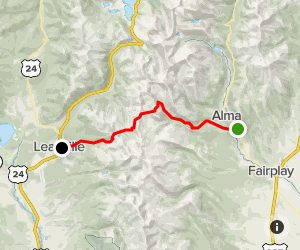
So today, I figured I'd see how far I could go up Mosquito Pass. I went out US Hwy 285 to Fairplay and turned north on Colorado State Highway 9. Just south of Alma, I turned west onto Park County Road 10.(Mosquito Pass Road). After a short distance, it intersects with (and becomes) Park County Road 12. But after I'd gone about a mile or so, the road was flooded, and I didn't really feel like trying to drive across the muddy flooded out section of the road, so I turned back, and this time took the fork to Park County Road 10 (Park Hill Road) and came back to Colorado State Highway 9 in Alma (Park Hill Road).
Turned north on Colorado State Highway 9 towards Hoosier Pass. Just before the summit, I turned left onto Park County Road 4, and went down to Montgomery Reservoir. I followed the road around to the west end of Montgomery Reservoir, where the road ends. Just above this is the Magnolia Mill, which I didn't notice until I looked at the satellite photos just now. So, I'll have to go back and see if I can get some photos of the Magnolia Mill.
Then, I rode back to Colorado State Highway 9 and went north over the continental divide at Hoosier Pass. Then, north on Colorado State Highway 9 through Breckenridge to Tiger Road. to the South Fork of the Swan River. Tried to make it up to Georgia Pass, but the road got too steep and rocky for me to proceed alone. Turned around and came back home via I-70.
Posted by Rob Kiser on June 28, 2022 at 9:56 PM : Comments (0) | Permalink
June 27, 2022
Loveland Pass, Hoosier Pass, Red Hill Pass, and Kenosha Pass
So, today (6/27/22), I hit Loveland Pass, Hoosier Pass, Red Hill Pass, & Kenosha Pass.
What I really wanted to do was Webster Pass, but I wasn't able to make it up there today.
First, I went down the hill to CycleGear and got some PJ1 chain lube.
Then I figured I'd hit Loveland Pass. So, I crossed the continental divide at Loveland Pass 11,990 ft above sea level. Then, down past A-Basin to Keystone to Montezuma Road. I went up Peru Creek to the Pennsylvania Mine.
Took some photos of the abandoned mine, then, back down Peru Creek to Montezuma Road and up to Montezuma, Colorado. I went through the old mining town and followed the signs for Webster Pass Rd. However, when I got to the place where Webster Pass Road crosses the Snake River, it was flooded pretty bad from the snow melt, and getting late in the day, and since I was riding alone, I decided to turn back.
Then, I rode through Breckenridge and crossed the continental divide again at Hoosier Pass. Then down into Fairplay, and on to US Highway 285. Then north and east across Red Hill Pass to Jefferson where it was raining pretty good, so I stopped and waited for the rain to stop. Then, up over Kenosha Pass, and back home.
Posted by Rob Kiser on June 27, 2022 at 10:05 PM : Comments (0) | Permalink
June 23, 2022
Georgia Pass
So, today (6/23/22), I hit Georgia Pass. I'm pretty sure it's the first time I've made it up there this year. My route looked like this.
I didn't have any trouble getting up there from the south side of the pass. But I couldn't really remember how rough the north side of the pass was, and as a storm was moving in, I decided to beat a hasty retreat home. I think that the South Fork of the Swan River Road isn't too bad, but the Middle Fork was pretty rough, as I recall. So, I beat a hasty retreat the same way I went up as a light rain started to fall. Somehow, I made it back OK, and it quit raining as soon as I got off of the continental divide.
Summit Georgia Pass 3:48 pm Thr June 23 56F. Headed home.
Mile 12.0 Jefferson............4:14 pm. 62F.
Mile 16.4 Kenosha Pass....4:19 pm.
Mile 24 Grant..................4:27 pm.
Mile 35 Bailey.....................4:28 pm
Mile 42 Pine Junction.........4:37 pm
Mile 51 Aspen Park........... 4:55 pm. 77F.
Updated Passbagger 2022 here.
Posted by Rob Kiser on June 23, 2022 at 7:03 PM : Comments (0) | Permalink
June 21, 2022
Corona Pass
So today, I figured I'd try to hit Corona Pass. I was able to make it approximately 10 miles up the dirt road, as far as Rifle Sight Notch, just below the James Peak Trailhead, where they have the dirt road blocked off with a gate, presumably due to snow on the road above this gate. The dirt road from Winter Park is alternately referred to as County Road 80 or Forest Service Road 149. The west side of the pass is named Corona Pass and the east side of the pass is named Rollins Pass. Took me about 35 minutes of riding on the dirt road to get to the gate. I'll try it again in a couple of weeks.
My route looked pretty much like this.
Posted by Rob Kiser on June 21, 2022 at 11:21 PM : Comments (0) | Permalink
June 17, 2022
Mosquito Pass
Looks like Mosquito Pass is still snowed in on the Alma side, but clear on the side up from Leadville.
https://www.alltrails.com/trail/us/colorado/mosquito-pass
Posted by Rob Kiser on June 17, 2022 at 9:41 PM : Comments (0) | Permalink
June 16, 2022
Pass-Bagger 2022
Try to document my passes for 2022:
Previous Pass-Bagger 2022 link here.
Pass Bagger 2022:
Kenosha Pass(Elevation 10,000 ft) - 3/25/2022
Red Hill Pass(Elevation 9,993 ft) - 3/25/2022
Hoosier Pass (Elevation 11,542 ft) - 3/25/2022
Loveland Pass (Elevation 11,991 ft) - 3/3/2022, 3/25/2022
Mount Evans(Elevation 14,265) - 6/10/2022 Friday
Kenosha Pass, Boreas Pass - 6/14/2022 Tuesday
RMNP, Milner Pass, Berthoud Pass - 6/15/2022 Wednesday.
Guanella Pass, Loveland Pass - 6/16/2022 Thursday.
Corona Pass (attempt) 6/21/2022 Tuesday.
Georgia Pass - 6/23/2022 Thursday
Posted by Rob Kiser on June 16, 2022 at 3:59 PM : Comments (0) | Permalink
Guanella Pass, Loveland Pass
So, I heard that Guanella Pass was open, and figured I'd hit that one today, as I've not ridden over it this year. I saw goats on the pass and I've seen them before, but it's been a while. Met some other motorcyclists on the summit taking pics. They flew out from New Jersey and rented motorcycles to ride. At the gas station in Georgetown, one guy realized he didn't have his wallet. See, people think it's easy to travel, but it's really not. Dude doesn't have a valid photo id to show them at the airport to fly back to Jersey. This is why I carry my passport in my back pocket 24/7.
So, I left them, and then rode up over Loveland Pass. Then down into Dillon, and home through the Eisenhower Tunnel. So, I crossed the continental divide twice today.
June 16
11:00 a.m. 75°F - Leave King Soopers gas station in Aspen Park. 0.0 miles.
11:30 a.m. 82°F - Grant. Trip meter = 26.5 miles.
11:45 a.m. - 12:10 p.m. - 70°F - Guanella Pass summit Trip meter = 40.0 miles.
1:00 p.m. 72°F - Loveland Pass summit. Trip meter = 68 miles
1:43 p.m. 82°F - Dillon. Trip meter = 85.3 miles.
2:43 p.m. 82°F - Home. Trip meter = 143 miles.
Posted by Rob Kiser on June 16, 2022 at 3:20 PM : Comments (0) | Permalink
June 15, 2022
Rocky Mountain National Park
Today, I did RMNP. My route looked something like this.:
I planned on getting to the entrance to Estes Park at about 3:00 pm. But I got there at about 4:00 pm. I was thinking that I could get into the park for free, but the workers were still there expecting payment. But once I crossed the park and came out on the west side, those employees were gone when I was there at 5:30 p.m.
1:15 pm Leave house. Trip meter = 0.0 miles.
4:01 pm East Entrance to RMNP. Trip meter = 81 miles.. 74°F.
4:51 pm On top. Trip meter = 101 miles. 57°F.
5:01 pm Milner Pass. Trip meter = 106 miles. 61°F.
5:30 pm West Entrance. Trip meter = 123 miles. 73°F.
6:25 pm Berthoud Pass. Trip meter = 171 miles. 58°F.
7:30 pm Home. Trip meter = 217 miles. 74°F.
Posted by Rob Kiser on June 15, 2022 at 9:56 PM : Comments (0) | Permalink
June 14, 2022
Boreas Pass
Today, the weather was nice, so I figured I'd check to see how Boreas Pass was looking. My route was pretty much like this, I think. There was no snow, and I met a guy named Brandon from Kentucky so I had someone to ride with.
So, now that I've done Mt. Evans and Boreas Pass, I'm thinking I may try RMNP tomorrow.
Posted by Rob Kiser on June 14, 2022 at 9:18 PM : Comments (0) | Permalink
June 11, 2022
Mt. Evans
Yesterday, Mt Evans opened for the season, and since it was sweltering here at the house, I rode up to the top of Mount Evans via Squaw Pass. Everyone is convinced that you need a reservation to ride to the summit of Mount Evans, but the truth is, not only do you not need a reservation, you don't even need to pay.
When I got there, I explained to them that the road is a state highway, and as such, they can't charge me to drive on it, I was just going up and turning around and coming back down, so I didn't need to pay. Then I rode to the summit. It was actually very nice weather. Stunning views as always. I'm always surprised by the view of the Rocky Mountains to the south and west of South Park. At the summit, the temperature was 54F.
Posted by Rob Kiser on June 11, 2022 at 10:54 AM : Comments (0) | Permalink
June 8, 2022
Fall River Reservoir
I've tried to make it up to Fall River Reservoir at least 3 times so far this year, without success. One day, I was trying to reach Fall River Reservoir when it started raining, hailing, snowing on me. Once, I tried to make it up there with Cody - I think that was last Saturday June 4th, 2022 when we ran into Rob Korotky. At that time, we ran into a section of the trail that was snow-packed and turned back.
Then today (6/8/22), I tried to make it up there again without success. Today, I made it 2.8 miles up from Fall River Road. This takes approximately 15 minutes of riding on a rough dirt road (full of large puddles, rocks/stones, etc.)
Apparently the distance should be 15 minutes going 3.1 miles. So at 15 minutes and 2.8 miles, I'm only 1/3 of a mile from the spillway, it seems.
Posted by Rob Kiser on June 8, 2022 at 2:57 PM : Comments (0) | Permalink
June 7, 2022
Gilpin County Ride - 6/7/2022
Today, I did a little ride through Gilpin County, the smallest county in the state. I'm riding up above Apex, Colorado, an old mining/ghost-town. But it's still snowed in. I've tried several times this year to make it from Apex to Tolland, but so far, no luck. There's still too much snow. This time. I made it up above Apex on County Road 4N to Kingston Peak Road, where it turns north towards Tolland. But I didn't make it far before the snow was too deep for me to cross. So, I turned back, and followed Apex Valley road back to 119 where I turned north and followed 119 to Missouri Gulch Road to Rollinsville. From Rollinsville, I was going to head up Rollins Pass Road to the Moffatt Tunnel, or up to Yankee Doodle Lake / Needle's Eye Tunnel. But once I got to Rollinsville, it started to rain, so I turned back and came home. Crazy to think that there's still too much snow for me to be riding my trails in June.
Posted by Rob Kiser on June 7, 2022 at 7:58 PM : Comments (0) | Permalink
June 3, 2022
Springtime In The Rockies
This is basically what my ride looked like today.
This was the first time this year I was able to make it from Russel Gulch/Nevadaville to York Gulch. I've turned back many times this year due to snow, flooded road sections, etc. But this time, I made it from Bald Mountain Cemetery, up Bald Mountain Lane to York Gulch. Then, down to Fall River Road, and up to Rainbow Road. I made it up Rainbow Road very near to Fall River Reservoir, where the road was blocked by snow, and it started to snow, and hail, and rain. Suddenly, I wished I was smart enough to check the forecast before I left the house. Riding down a muddy dirt road when it's raining and hailing on you makes you question your sanity. Springtime in the Rockies. Somehow, I made it back home and beat the storm home, for the most part.
Posted by Rob Kiser on June 3, 2022 at 5:37 PM : Comments (0) | Permalink