« Day 14 - Coldfoot, AK to Deadhorse, AK (Fri 8/1/14) | Main | Day 16 - Coldfoot, AK to Denali National Park, AK (Sun 8/3/14) »
August 3, 2014
Day 15 - Deadhorse, AK to Coldfoot, AK - Atigun Pass (Sat 8/2/14)
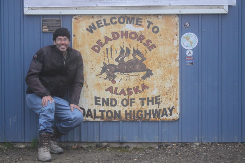
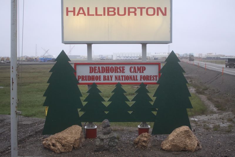
Above: Deadhorse, Alaska - the northern terminus of the Dalton Highway.
Additional photos in the Extended Entry.
(Sat 8/2/14)
Update: I am alive and well and resting peacefully in Coldfoot, Alaska, a stopping point on the Dalton Highway (AK Highway 11).
Starting Odometer: 19,604
Ending Odometer: 19,874
Miles Driven Today: 270
Miles Driven This Trip: 5,221
This is a rough map of where I drove today.
Atigun Pass
This morning, we wake up in a modular housing unit in Deadhorse, Alaska. It's raining, and cold. Temp about 37 degrees F. We meet for breakfast, then catch shuttle to the Arctic Ocean. BP has everything locked down tighter than a frog's ass. You have to clear a military-style checkpoint, Then, the bus driver takes us to the shore of the Arctic Ocean.
"OK...You can get in the ocean, but no swimming today. They're doing seismic testing."
Now, keep in mind, it's nearly cold enough to snow. And the water is so cold it's beyond comprehension. I can't even get near the oceans without freezing. But, I take my boots off and waddle into the ocean for a shot.
Remus taks a few pics of me. I feel like I will surely lose my hands and feet.
Get back on the bus, now back to our little modular housing unit in Deadhorse. Now, we leave to gas up.
There are 6 of us that will be riding bikes back south on the Dalton Highway today.
We leave to gas up the bikes. Only, I forget to gas up my extra 2 gallon gas tank. As we roll out of town, I realize my mistake and turn back. Rush back and fill up the 2 gallon gas tank. I'll need it to make it into Coldfoot, 250 miles south.
Now, Remus comes back for me. He sees that I'm missing. We touch base, and ride south.
It's 37 degrees F (cold), and raining. The Dalton Highway is not a paved road. Well, sections of it are paved, but most of it is a dirt road, on a good day. On a wet day, it deteriorates into a muddy nightmare.
We're blowing south on the Dalton Highway, and you just can't know how bad this is. It's freezing cold, Wet. And slippery. So, you're sliding all over the road. Every time the road changes texture, you need to be aware. Some sections are paved. And we'll be running along at 80 mph, and then suddenly, you're in the slippery clay morass that sends you sliding hither and yon.
Mostly, in the wet clay sections, you're just following wherever the road wants to take you. It will push you left or right. In the curves, you want to lean to make the turn, but you can't lean in this goop at all. You just hang on and pray and see where the road wants to send you.
Now, we come to one of the many passes. These passes are so steep you can't know. Normally, a railroad grade is no more than 3%. A highway is normally not more than 6% grade. These passes are 12% grades. Straight up and straight down. You're looking up the pass and thinking "I don't think I can make this, and then you get to the top, and stand on the brakes and think "i'll never make it down this hill."
That's how steep the roads are. Then, they change from pavement to mud without warning. And, there's trucks coming at you head on in your late with no plan of slowing down. So, we're riding down this death trap at 37 degrees F all morning in a light rain, and it sucks. There just aren't words of dhow bad it sucks.
Remus stops to put on more gear. I put on all my gear before we left. So, whether I'm cold or not makes no difference. I'm not stopping, because I'm already wearing everything I have.
After about 70 iles, we pull over not a private camp. Remus is too cold to go on, and wants to warm up. This is a private (closed) camp. It's not open to the public. But, we walk in and I just explain that Remus needs to warm up. They're very nice, and even make us a pot of coffee.
Now, we head on again.
Just death.
Like, the worst ride ever. The coldest, most difficult terrain you've ever been on in the rain. For 250 miles. I feel like I could lose my hands, but we keep going on. The rain never lets up. So that I'm constantly clearing my visor for hours. Down a muddy road. Full of trucks going the other way that flip us off, each and every one.
We all just count the miles.
My left hand hardly works any more. Normally, he shifts for me...he does the clutch. But the last two days, he's not been happy. I order him...grab than handle-bar grip and hang onto it. But my left hand no longer works. Only, it just lays there. Too tired to comply.
This goes on for about 5-6 hours, and then we climb Atigun Pass.
As we cross the summit of Atigun pass, I notice the sky looks lighter.
As we roll down Atigun Pass, we realize that we're out of the storm. We're going to live.
Remus and I stop and kiss the ground. Glad to be alive. Now, I'm taking photos again.
We're riding and so happy to be in the warm sun again. Such a beautiful day.
I start taking photos, and Remus slows down to conserve fuel. I pass the group of 4 other bikes were were at the Arctic Ocean with this morning. Now, it's nothing but me and a BMW and we're racing. He thinks he can take a KTM, but I disabuse him of that notion.
Finally, I roll back into Coldfoot, but Remus isn't here. Where is he? I thought he was ahead of me.
I fill up with gas, and then turn back north to go look for him. I find his bike 3 miles north of town. Return to gas station, find Remus. He's pissed that I left him. I finally figured out that he was with the group of 4 riders when I passed them, and one of the Beamers had gone on ahead. So, I passed him without reaizling it.
We pour two gallons of gas into Remus's tank and roll back into Coldfoot, glad to be alive.
Photos in the Extended Entry.
Above: Driving from Deadhorse, AK to Prudhoe Bay, AK.
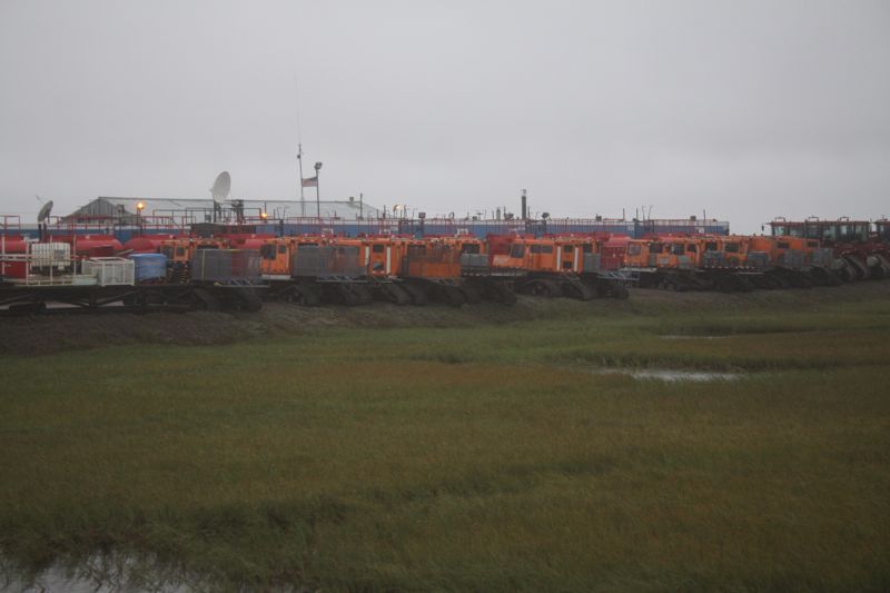
Above: Driving from Deadhorse, AK to Prudhoe Bay, AK.
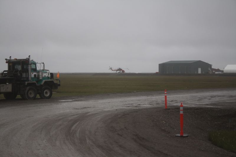
Above: Driving from Deadhorse, AK to Prudhoe Bay, AK.
Above: Driving from Deadhorse, AK to Prudhoe Bay, AK.
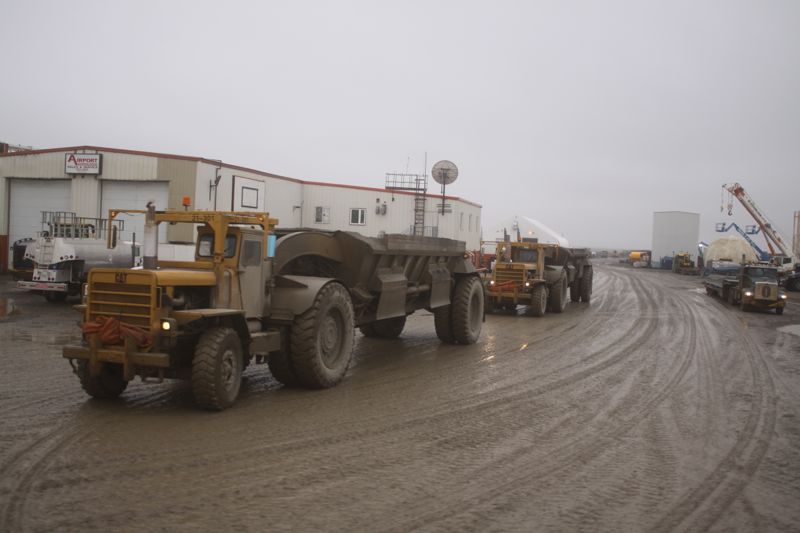
Above: Driving from Deadhorse, AK to Prudhoe Bay, AK.
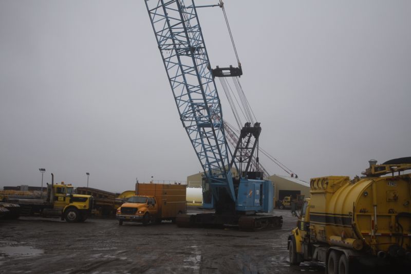
Above: Driving from Deadhorse, AK to Prudhoe Bay, AK.
Above: Driving from Deadhorse, AK to Prudhoe Bay, AK.
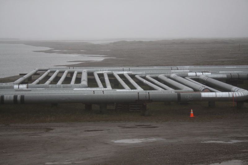
Above: The Endicott Pipeline.
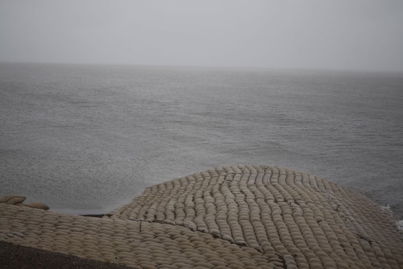
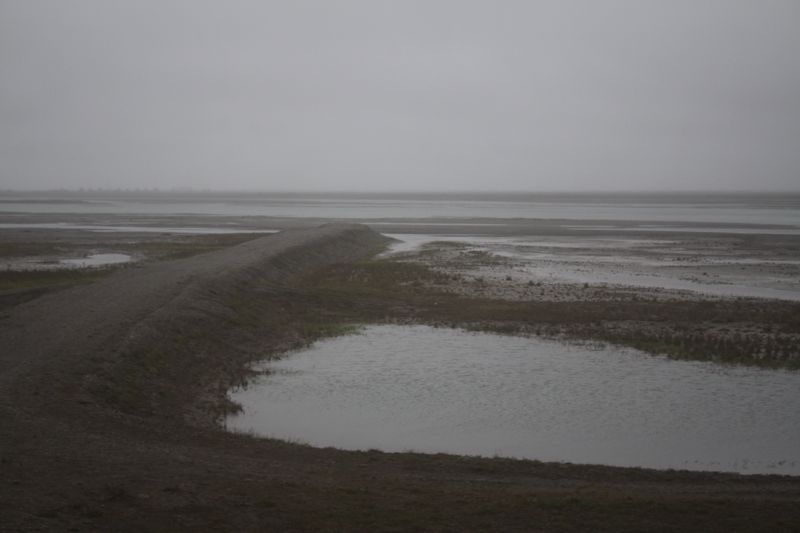
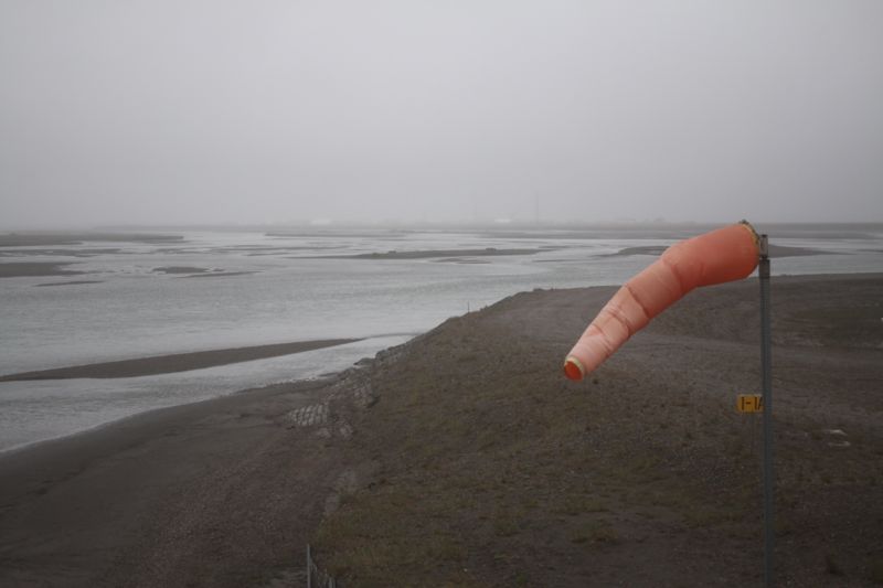
Above: The Arctic Ocean.
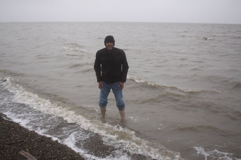
Above: Standing barefoot in the Arctic Ocean. So cold I thought I would lose my feet.
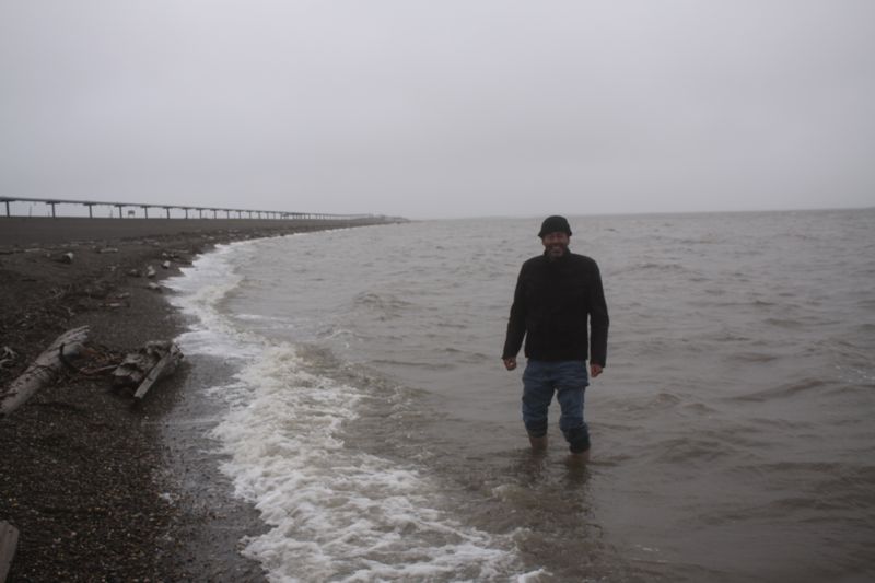
Above: Standing barefoot in the Arctic Ocean. So cold I thought I would lose my feet.
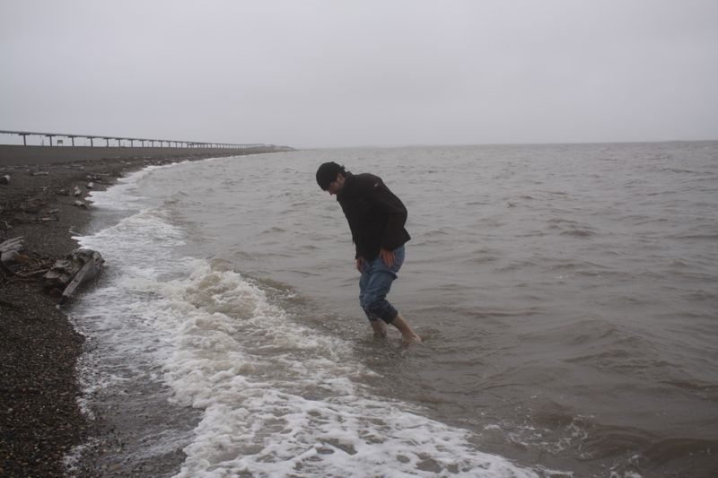
Above: Standing barefoot in the Arctic Ocean. So cold I thought I would lose my feet.
Above: Deadhorse, Alaska - the northern terminus of the Dalton Highway.
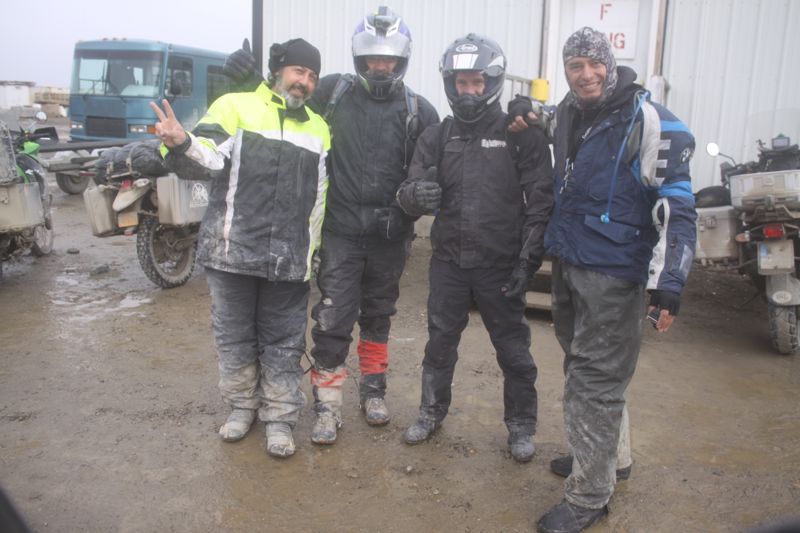
Above: These guys stayed at the Deadhorse Camp also, and went on the tour with us to the Arctic Ocean. BP controls access to the Arctic Ocean, so the only way you can get there is on a scheduled tour operation.

I didn't take any photos on the 180 mile motorcycle ride from Deadhorse, AK to Atigun Pass in the Brooks Range. It was 37 degree F, and rained on us the whole time. So, I had my cameras packed away. However, when we crossed Atigun Pass, we crossed into better weather. Then, Remus and I got out our cameras, glad to be alive and in nice weather, and began to shoot.
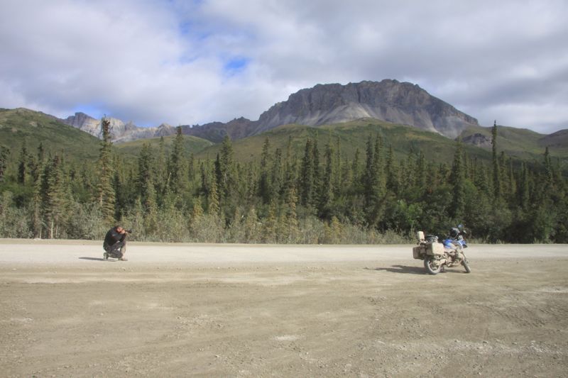
Above: Remus shooting the BMW GS1200R he rented in Anchorage. (In Romania, he drives a Harley).
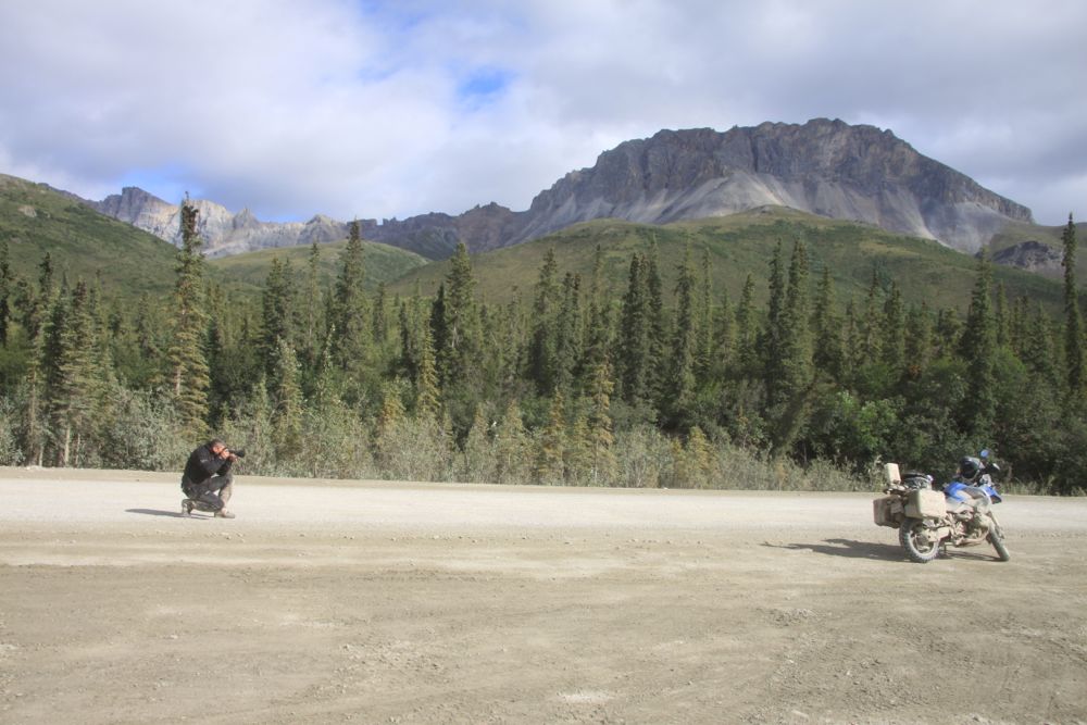
Above: Remus shooting the BMW GS1200R he rented in Anchorage. (In Romania, he drives a Harley).
Above: Remus shooting the BMW GS1200R he rented in Anchorage. (In Romania, he drives a Harley).
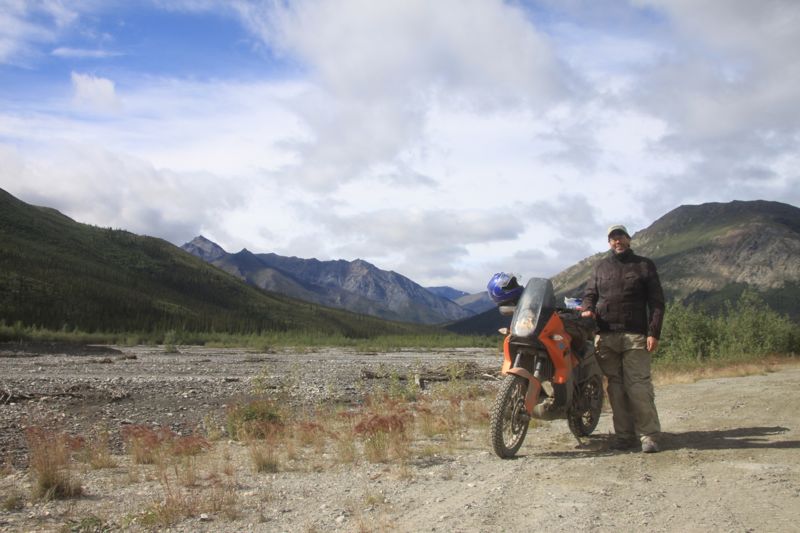
Above: So happy to have finally driven out of the cold rain and into the warm sunshine. Remus was so cold we stopped in a closed camp to warm up. I was cold, but I had all my gear on, and I was OK to keep driving.
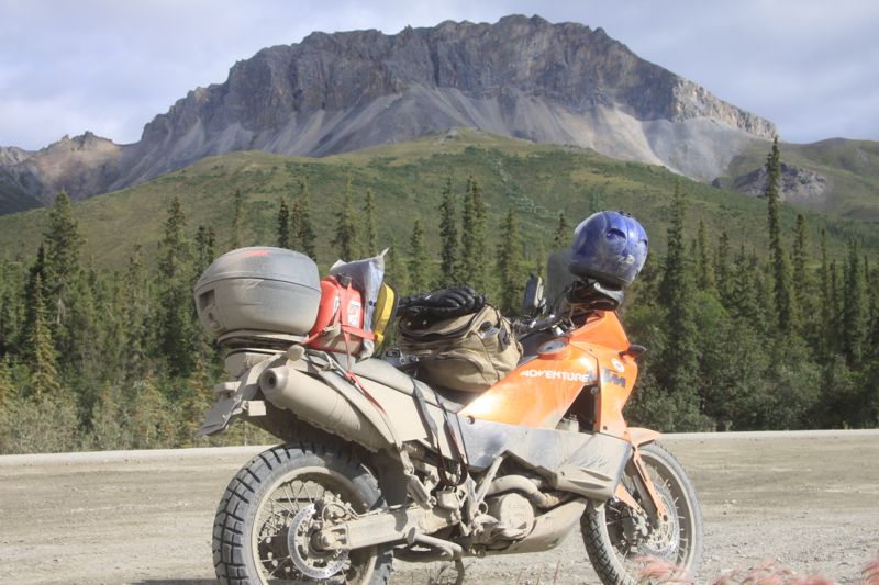
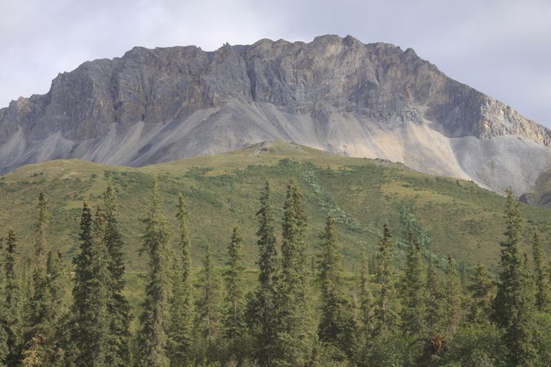
Above: The Brooks Range, between Atigun Pass and Coldfoot, Alaska along the Dalton Highway (AK 11).
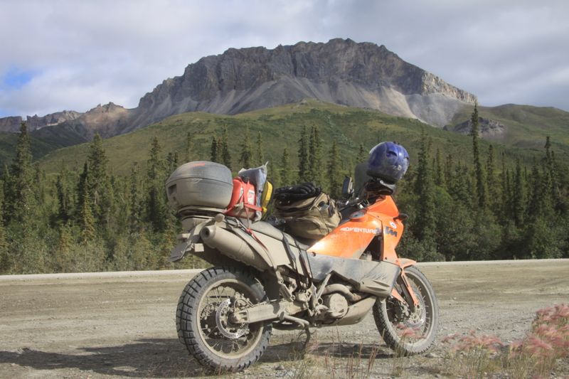
Above: The Brooks Range, between Atigun Pass and Coldfoot, Alaska along the Dalton Highway (AK 11).
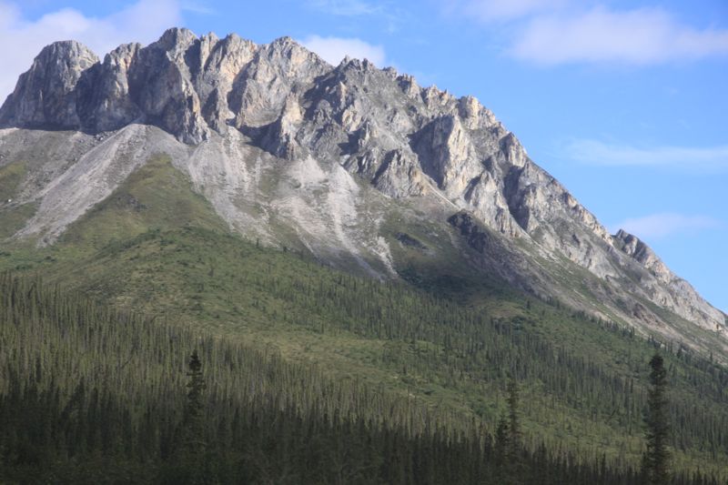
Above: The Brooks Range, between Atigun Pass and Coldfoot, Alaska along the Dalton Highway (AK 11).
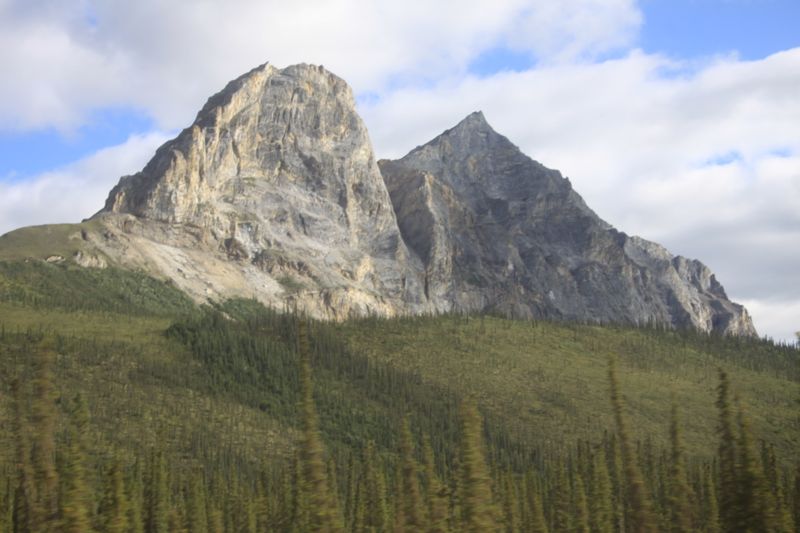
Above: The Brooks Range, between Atigun Pass and Coldfoot, Alaska along the Dalton Highway (AK 11).
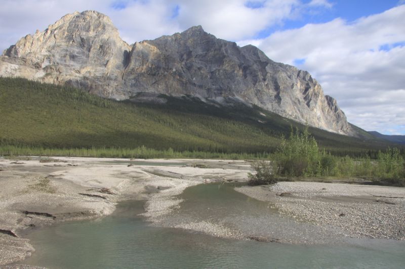
Above: The Brooks Range, between Atigun Pass and Coldfoot, Alaska along the Dalton Highway (AK 11).
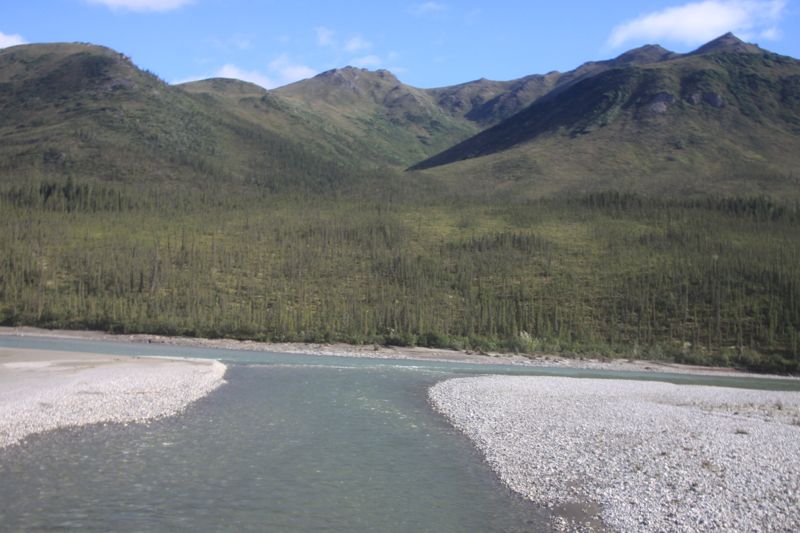
Above: The Brooks Range, between Atigun Pass and Coldfoot, Alaska along the Dalton Highway (AK 11).
Posted by Rob Kiser on August 3, 2014 at 10:49 AM
Comments
One EPIC trip! You are the envy of all us mere mortals. when do you expect to be home?
Posted by: Steve on August 3, 2014 at 9:32 PM
Steveo - Not sure on the return. But I'm definitely winding down the trip. :)
Posted by: Rob Kiser on August 4, 2014 at 9:46 AM
That Halliburton sign is funny. Doesn't much look like a National Forrest.
Posted by: mgb on August 21, 2014 at 1:52 PM
Yeah, it's a poke at the tree-huggers. They're pointing out, I think, that the tree-huggers are all freaking out about their oil production operation, but there are no trees up there. Zero. It's all tundra.
Posted by: Rob Kiser ![]() on August 22, 2014 at 3:09 PM
on August 22, 2014 at 3:09 PM