« Day 13 - Travelers | Main | Day 14 - Coldfoot, AK to Deadhorse, AK (Fri 8/1/14) »
August 1, 2014
Day 13 - Tok, Alaska to the Arctic Circle - Ride North (Thr 7/31/14)
Above: 3 miles west of Tok, Alaska on Alaska Highway (AK 2), at the entrance to "Mukluk Land", we passed the remnants of a Land Train. This is the only time that I've ever seen one (aside from photos).
Additional photos in Extended Entry.
(Thr 7/31/14)
Update: I am alive and well and resting peacefully in Coldfoot, Alaska. Last night, at about 11:30 p.m. Alaska Time, I reached the Arctic Circle on a 2010 KTM 990 Adventure.
Starting Odometer: 18,860
Ending Odometer: 19,354
Miles Driven Today: 494
Miles Driven This Trip: 4,701
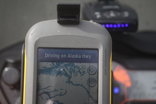
Here's a map of where I drove today.
The ride has been a dream. Not really sure what to do at this point. I could continue north to Deadhorse, and the Arctic Ocean, but my chain and sprockets are completely shot. I'm going to try to limp back into Fairbanks at the KTM dealership and ask them if they can replace my chain and sprockets. They were nice enough to set me up with a new set of tires yesterday when I showed up at their door at 4:00 p.m.
It never really did get dark at all last night. It got to like...dusk...like...the sun did technically go beyond the horizon, but not by much. Then, after about 1:00 a.m., it starts to get lighter again. Pretty wild really.
Here's what I wrote about the ride last night:
=================================
In the morning, I roll out late...about 11:00 a.m. I think.
Gas up. Now, there's a guy here at the pumps. He's shipped his bike over from Japan. He's been on the road for a year. Drove from Germany to east asia.
So, we ride together for a bit. Heading towards Fairbanks. We're both going there. So, that's easy enough. He's slow, but I stop to take photos, so it works out. I stop and shoot, then I catch up to him. We drive like this for some time. From Tok, Alaska to the next town of Delta Junction. This is the end of the Alaska Highway, so we stop to pause for photos here.
All of the gear they used to build the Alaska Highway they just parked right there in a field and left it to rust away. Kinda sad, really.
Now, I leave for Fairbanks, but he's going to stay in this town. I roll out for Fairbanks. Set my GPS for the KTM shop.
Just outside of Fairbanks, there's a Air Force base (Eielson Air Force Base) and these jets are doing fly-bys over the air force base. Just insane. Team America, Fuck Yeah!!!
Presently, I'm rolling through town, following my GPS to the KTM dealership.
Now, this is odd...this GPS...because it make it so you know where to go even though you've never been here before. So, I feel like I'm faking it. Like I'm a phony, but I drive right to the Motor Sports North place. Walk in and ask them what I can do to get going.
The find me some tires, and start installing them. About 2 hours later, I leave the store. Now, my plan is to go north to the Arctic Circle. But, when I get on the Dalton Highway (11), I know that food, gas, and lodging will be hard to find. So, I've marked the mile markers for the gas stations and hotels along the way.
I fill up with gas, and take off.
The first thing I notice is that it's a lot further to the Dalton Highway (11), than I had estimated. I thought it would be about 30 miles away, but instead, it was more like 60 miles away. Then, I figured I'd drive to the Yukon Crossing, get gas, and spend the night. I left town without any food. Only I had 2 bottles of gatorade. And some trail mix.
As I drive, slowly it dawns on me that the place I'm looking for will be much further than I had estimated. Also, it's very late when I leave town, so it's going to be dark by the time I get to the hotel. And, I didn't bother to check to see if they had any vacancies.
And, as it turns out, the road isn't paved.
So, pretty soon, I find myself rolling north on a dirt road through Alaska, and slowly it dawns on me that I'm in a life-or-death-survival type of situation. If I stop, the mosquitoes swarm me in a way you can only imagine. I have no bug spray. No mosquito netting. No food. No reservation. And I'm driving on one of the least traveled dirt roads in the state.
By the time I get to where Yukon Crossing should be, I realize I'm in trouble. I don't see any gas stations or motels, and the sign says "Next Service 120 miles". I'm like...."Oh wow..>I'm really screwed now." I've gone about 150 miles at this point. So, I can't go back. I won't make it. My only chance is to keep pushing north and hope that somehow I make it on the gas I have with me. It's going to be close though. I figure that, if I an make it to 190 miles on the current gas in the tank, then my 2 gallons in the gas can will get me another 80 miles. So, that means that I have to get to 190 miles on the gas in the tank, plus 80 miles for the gas in the can, gets me to 270 miles, which is 120 miles past 150.
It's going to be very close. Also, it's getting late. So, I'm assuming that I'll be dodging animals, driving in the dark. But as I drive, it doesn't get any darker.
Finally, I find two other motorcycle riders parked atop a hill taking photos. I'm rolling North. They're heading South. I pull over.
"Ladies....how's it going?" I ask.
They just laugh. I explain my predicament.
"Where is Yukon Crossing anyway?" I ask.
"Oh....it's about 40 miles back the way you came from. It's easy to miss. There's no sign or anything."
"great."
"But, if you keep going, you can make it to ColdFoot." It's 80 miles from here. Can you make that? Do you have enough gas?"
"Yeah...I think so. I'll make it."
"That's where you should go then. It's the only town that has gas between the river and Deadhorse."
They flag everything as #RideNorth and give me one of their stickers, which is pretty cool I think.
Update: These are the guys I ran into. I thought about doing something similar to this...they funded their trip through KickStarter. Nice.
So now, I'm rolling north. At each hill, I just pull in the throttle and coast down the hills to save fuel.
Presently, I come to the Arctic Circle sign. Stop and get a few pics using the timer on the DSLR.
Now, rolling on towards Coldfoot. The thing that concerns me is that a) will I make it there before I run out of gas and b) even if I do make it there, will it still be open? It's now after midnight, and still daylight somehow, but I'm not clear that they're selling gas all night and c) even if they are open and do sell me gas, will they have a room? I was so stupid I didn't bother to ask. If they don't have a room, and they're all locked up, and they're closed, I think I'll have to break into a room to get away from the mosquitos. That would be insufferable.
The bike runs out of gas, I pull over to fill the left tank from my gas can on the seat. It puts about 2 gallons into the tank, which should get me to Coldfoot. The mosquitos are so bad here there are no words. They will carry you away.
Now, rolling toward Coldfoot, coasting down hills. Trying to stretch it. Finally roll into Coldfoot on reserve with the fuel light lit up. Get in at 12:15 a.m. They have a room for me. It's $200. It's the best money I ever spent.
Photos in Extended Entry.
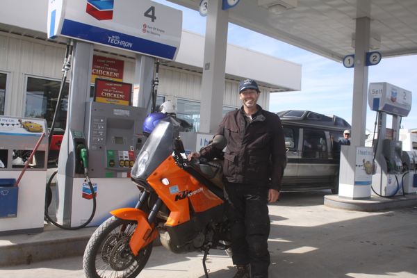
Above: Gassing up in Tok, Alaska.
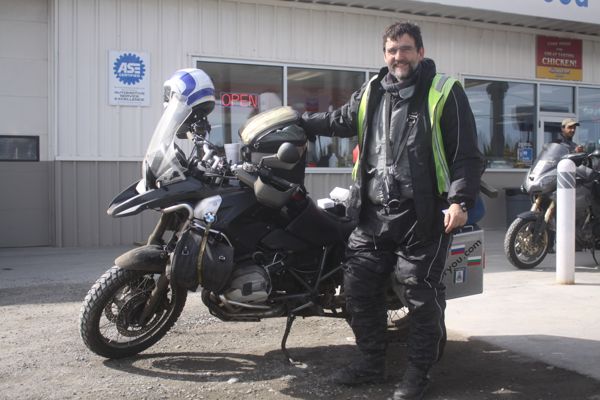
Above: Another road warrior gassing up. This is Thomas Lehmen.
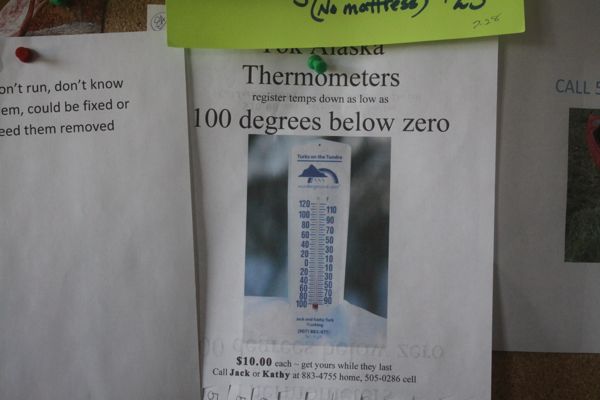
Above: Need a thermometer that goes down to 100 degrees below zero? We've got you covered.
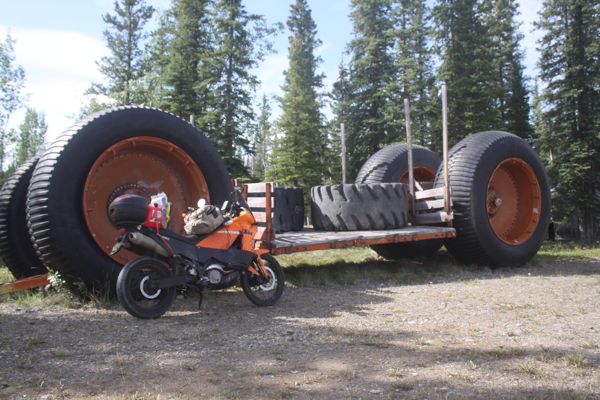
Above: 3 miles west of Tok, Alaska on Alaska Highway (AK 2), at the entrance to "Mukluk Land", we passed the remnants of a Land Train. This is the only time that I've ever seen one (aside from photos).
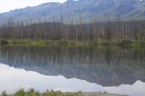
Above: A lake just west of Tok, Alaska in Tanacross, AK on the Alaska Highway (AK 2).
Above: A lake just west of Tok, Alaska in Tanacross, AK on Alaska Highway (AK 2).
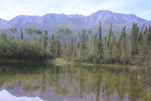
Above: Driving west from Tanacross, AK on Alaska Highway (AK 2).
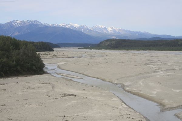
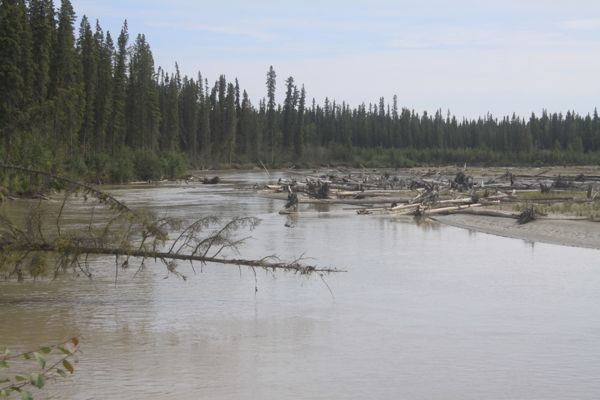
Above: The Johnson River at milepost 1380 on the Alaska (ALCAN) Highway, 41.5 miles southeast of Delta Junction (MP 1422), and 66 miles northwest of Tok, Alaska (MP 1314).
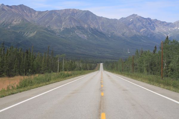
Above: No destination set. Driving the Alaska Highway.
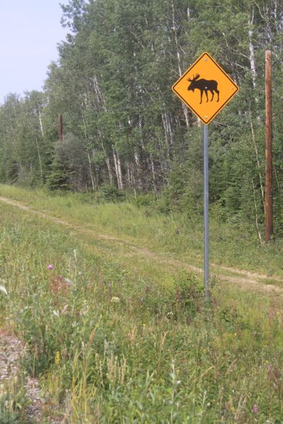
Above: Yeah...watch out for moose. Hitting one on a motorcycle would be a bad thing.
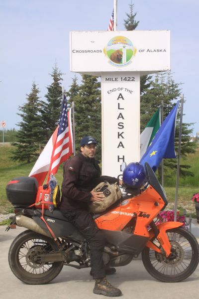
Above: Delta Junction at last. This is the northern/western terminus of the Alaska Highway at Milepost 1422.
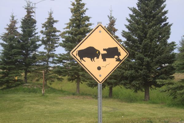
Above: I love how the buffalo is larger than the vehicle, and the wheel comes rolling off the vehicle. Pretty graphic.
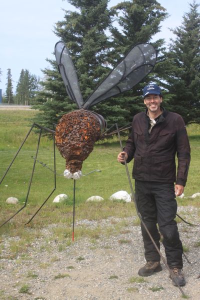
Above: Me posing with an Alaskan mosquito at Delta Junction (this is a baby one).
Above: A river just east of Fairbanks, AK.
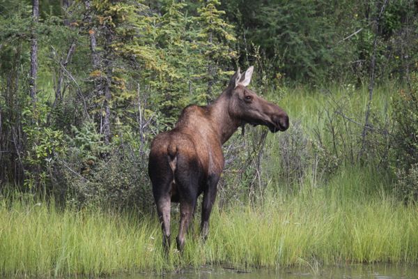
Above: A cow moose in a flooded field just outside of Fairbanks, Alaska on Highway 2, the Richardson Highway..
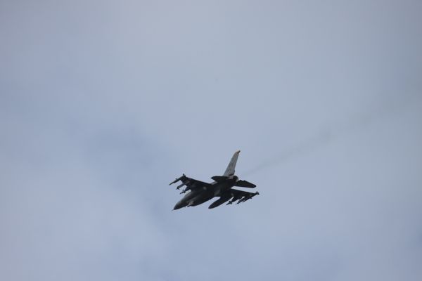
Above: Fighter jets doing touch-and-go landings at Eielson Air Force Base just outside of Fairbanks, Alaska on Highway 2, the Richardson Highway.
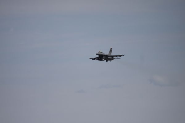
Above: Fighter jets doing touch-and-go landings at Eielson Air Force Base just outside of Fairbanks, Alaska on Highway 2, the Richardson Highway.
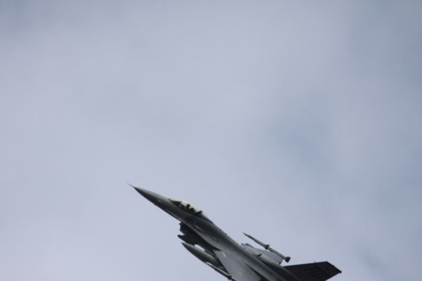
Above: Fighter jets doing touch-and-go landings at Eielson Air Force Base just outside of Fairbanks, Alaska on Highway 2, the Richardson Highway.
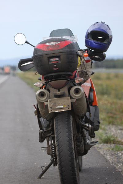
Above: KTM parked along the side of Highway 2, the Richardson Highway at Eielson Air Force Base just outside of Fairbanks, Alaska.
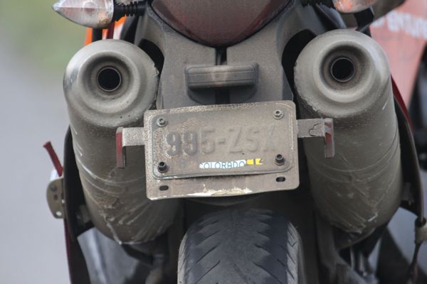
Above:Someone didn't believe I'd driven from Colorado, so I ran a finger across my plate so they could see that I was, in fact, from Colorado.
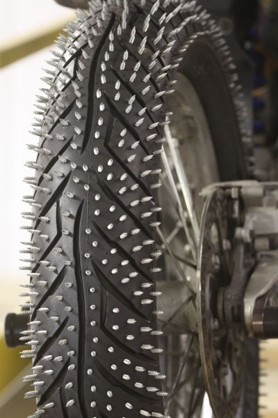
Above: A guy at the KTM Dealership in Fairbanks makes these studded tires and then they race on the ice in the winter at a track he sets up on a frozen lake. I'd have to get run over with this thing.
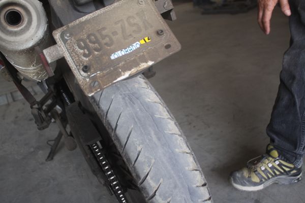
Above: I put this new tire on my bike earlier this year. It had maybe a thousand miles or so on it before the trip. This is what the Alaska Highway does to tires. It eats them.
Posted by Rob Kiser on August 1, 2014 at 10:47 AM
Comments