« Day 1 - Morrison to Steamboat Springs | Main | Day 2 - Tear Down in the Parking Lot (Sun 7/20/14) »
July 19, 2014
Day 1 - Morrison, CO to Craig, CO (Sat 7/19/14)
7/19/14
I am alive and well and resting peacefully in Craig, Colorado.
Starting Odometer: 14,651.3
Ending Odometer 14,969.0
Miles Driven Today 317.7
Miles Driven This Trip: 317.7
Max Speed: 105 mph
Times stopped by police: 0
Injuries: Slight sunburn to the backs of both hands.
Near accidents: Almost hit an elk. One time, shooting through the lens with no hands, I drifted into oncoming traffic accidentally. Also, now that I have the iPhone mounted on top of the Ram mount, I find myself driving with one hand and sending text messages 2 miles above sea level.
Mechanical issues: For some reason, my right gas tank isn't working. Also, I have a small oil leak, apparently.
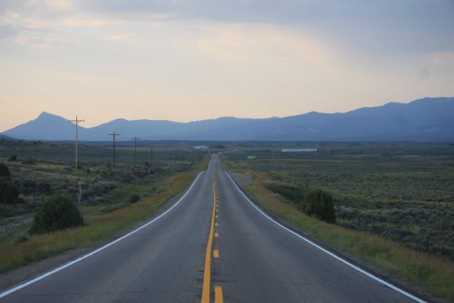
So, this is the path that I ended up taking today.
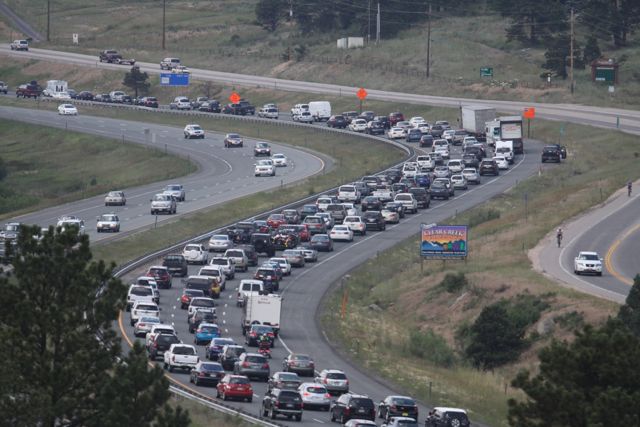
I-70 was a complete parking lot, so I doubled back once I got to Floyd Hill. I decided to run back down the hill to Golden, head north on 93 a bit to the Golden Gate Canyon road, then take Golden Gate Canyon up to Peak to Peak Highway. That worked out really well, and I never saw any significant traffic for the rest of the day, really.
The I-70 Parking Lot
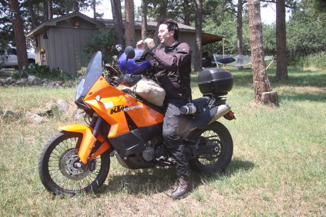
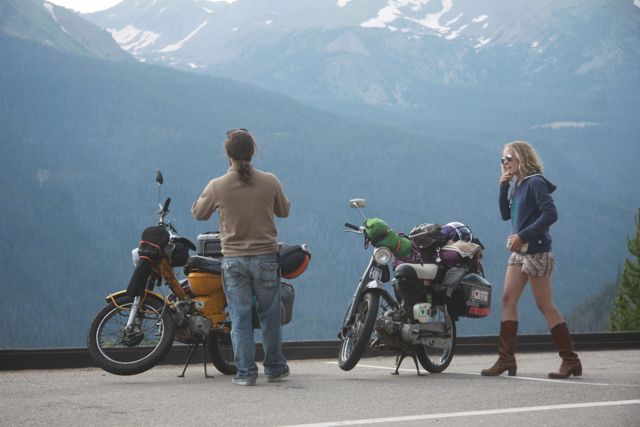
I finally leave home at about 12:30 or 1:00 today. Stop by and ask Bud to take some shots of me. They always take pics of me before I take a big trip. They're good that way. Ask them to hold my mail and I'm off.
But I-70 Westbound is just a parking lot, so I roll back down the hill to Golden, and then head north to Golden Gate Canyon. At Golden Gate Canyon, I turn west and climb up into the foothills on a nearly empty road.
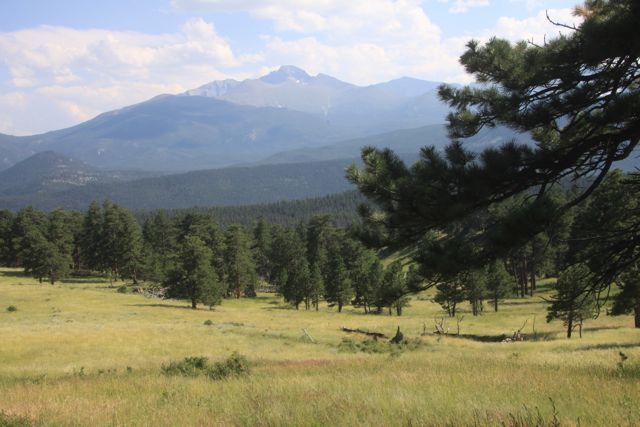
I knew that no one would be on this road because it doesn't really go anywhere. But it gets me onto the Peak to Peak Highway, and I like that road, so I follow the Peak to Peak Highway north towards Estes Park.
The last time I was on this road was back in March, and it was crazy cold then, so that I was always watching for ice or snow in the turns. But now, it's an insane 90 F some how.
I don't believe in Global Warming, but I promise you today is the hottest day of the year so far.
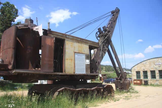
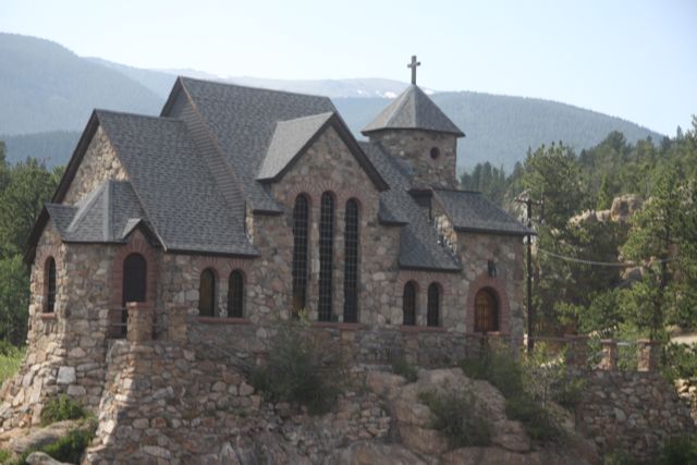
Stop in Nederland to shoot the Steam Shovel. It's the only one left in the world that was used to build the Panama Canal. Which is kinda funny because I was at the panama canal roughly a year ago. And it's weird to think how it ended up in the mountains of Colorado.
Then north into Estes Park. I see the shortcut that we took back in March that Ted and Steve knew about, but now I see that it's not really technically a shortcut. There's signs there that say it's the way to Rocky Mountain National Park. I'd just never noticed the signs before.
As I roll up to RMNP, my fuel light comes on. At 108 miles, and I start to panic. How can this be? I can normally go 240 miles on a tank of gas. Why is the fuel light coming on at 108 miles? Is my gas mileage that bad? I'm clearly carrying too much junk. I decide to buy a box and just ship about half of my crap home to save weight. I can feel the extra weight every time I speed up. And every time I hit the brakes. I can feel the difference in how it handles through the turns. What was I thinking?
So, I pay the $10 motorcycle fee to enter RMNP, and promptly turn around and go back down into Estes Park to fill up.
I fill up the left tank, and then I go to fill up the right tank, but the right tank is still full. Suddenly, I realize that I forgot to turn the right fuel tank back on. I turned off both tanks for the oil change, and the right tank never got turned back on. Doh!
So, I buy 2.2 gallons of gas, and go on my way back into the park. Feeling stupid, but glad to know why I only went 108 miles before the fuel light came on.
So, onces I got to Estes Park, I decided that I was going to make my GoPro camera work, probably for the first time ever. I have a GoPro Hero 3 Black Edition that I bought in SF last year, I think. But the nimrods at the TSA stole much of my GoPro related technology, so I've never really used it.
Somewhere on Trail Ridge road, I decide to get the thing out and make it work. It's complaining that there's no SD card in the GoPro. Things like this. But I take out the card, reinsert it, and sync it with my iPhone using the GoPro app.
I tape the iPhone on top of the thousand dollar Garmin brick, and the GPS works well for this...for a base for the iPhone.
So I've taped the iPhone on top of the GPS with black electrical tape. Now, I put the GoPro into my new helmet mount, and sync it up with the iphone. As I drive down the road, I can see what I've filming via WiFi, which is just insane, really.
Only, there's like a 4 second delay. So, when I pass a car, if I'm watching the iphone, 4 seconds later, I see another car coming (in the iPhone), that isn't really there. A very strange feeling.
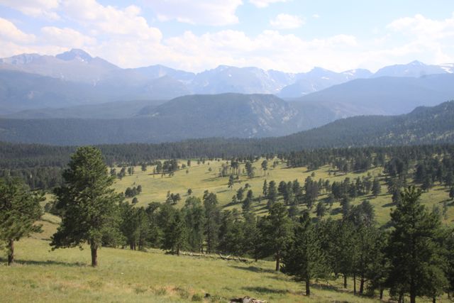
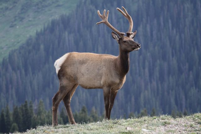
By the time I summit Trail Ridge Road, the temperature has dropped down to a tolerable 70 degrees. There's not as much traffic as I'd feared. People are stopping to shoot elk and I'm like....puhleeze...I can shoot elk in my yard. Step aside, tourists. Lots of out-of-state plates. Nebraska. Kansas. All the flatlanders come out here to squeeze the life out of our mountains. I wish they'd just go back home and get out of my hills.
This time, I manage to make it through RMNP without getting stopped, having my bike towed, etc. This time, I sort of watch the speed limit and take my time.
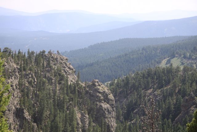
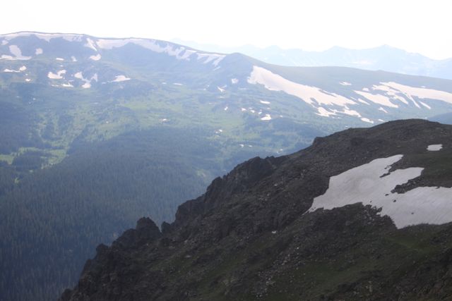
Rabbit Ears Pass
Once I get on US 40 heading west, I realize that I've never seen this stretch of road before. And that sort of excites me. I think about the adventure ahead, and how much fun it will be. For the first time, it begins to dawn on me how cool this trip might be.
I've been wanting to see Steamboat Springs for a long time. Never been there. Always wanted to check it out. Never got around to it.
Now, I'm 26 miles from Steamboat Springs and my fuel light comes on and I know that I won't make it. I'll run out of gas before I get there. For some reason, only one of my gas tanks is working.
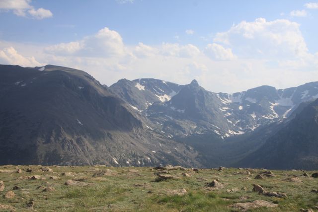
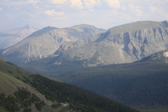
Why? I have no clue. But this is where we are. I'm climbing Rabbit Ears pass on US 40 heading west and every time we crest a hill I hope to see that we've crossed the continental divide and it will be all downhill from here on out.
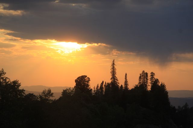
But every hill we crest just reveals yet another hill to be conquered. My best guess is that I can go, at max, 125 miles. I finally reach the summit of Rabbit Ears pass just as the engine dies, and now it's all downhill into Steamboat Springs - I think.
Coast for about 5-10 miles...rolling downhill so fast you wouldn't believe it. Runaway truck ramps on the right, but I just keep on rolling down the hill. Shut the engine off. Put it in neurtral, and I'm coasting down the continental divde going 70 mph.
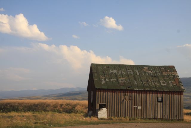
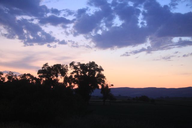
Finally, the road sort of levels out and then climbs slightly, and I roll to a stop beside some random farmhouse.
Fortunately, I put a small fuel bottle in the Givi rear case. It holds one liter of gas I poured out of an old 5 gallon jug I discovered in the garage at home. Lord only knows how old it is. I empty the contents into the left gas tank on the side of the road by the barn. I get most of it into the gast tank. Some on the ground. Some on the bike. Some on me. Probable equal parts to all 3 places.
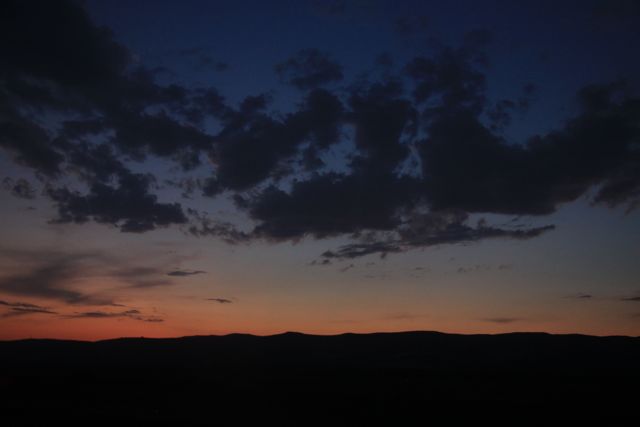
Bike fires right up. Now, I'm rolling down into Steamboat Springs, Colorado.
I've only got like 6 miles to go, according to my iPhone. Now, the iphone is taped over my Garmin Montana 600 that is mounted to the handlebars of the KTM with a Ram Mount. The mount is amazing. Twist a knob and it will swivel in any imaginable direction. Twist it back and it locks in place and never moves. The Ram mount is the bomb.
The GPS, however, is as useless as tits on a bull.
It didn't come with any maps in it, to speak of. For $600, I mistakenly thought that maybe it should. But, I thought...just buy the maps. Don't be cheap. It will all be worth it in the end. So I shell out another $80 for the City Maps of North America (U.S. including Alaska, and also Canada.) They call them City Maps, but apparently, that's not at all what they are. They're just maps. But the people at Garmin are idiots, so nothing surprises me.
Even after getting a 32 GB MicroSD card and installing it in the GPS unit, and putting the maps on the MicroSD card, the Montana still won't do simple turn by turn directions like even the most basic GPS units. Finally, I figured out how to tell it which city I wanted to go to, and set it to Estes Park, Colorado. Basically, then you could watch it, and it would show you the road ahead, but without suggesting which way you might go. So, if you know where you're going, and don't need directions, then I guess that it shows you the turns up ahead. You can't make it show North at the top. And it does know the speed limits, but shows them in kim/hr, which is useless, of course.
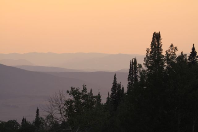
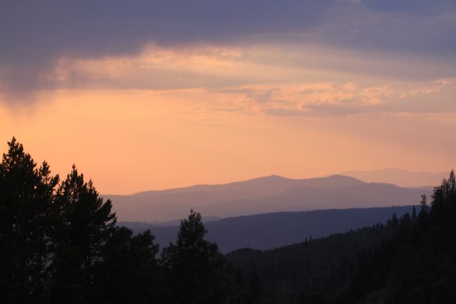
I get into Steamboat Springs, and there are no rooms. My sister finds me a room in the next town to the west...Craig, Colorado. The sun is setting, and now I've got to make a balls out run to the next town and I'm tired and sore. Somehow, I've got to make it another 40 miles or so before I crash for the night. Ugh.
Photos in the Extended Entry.

Posted by Rob Kiser on July 19, 2014 at 11:23 PM
Comments